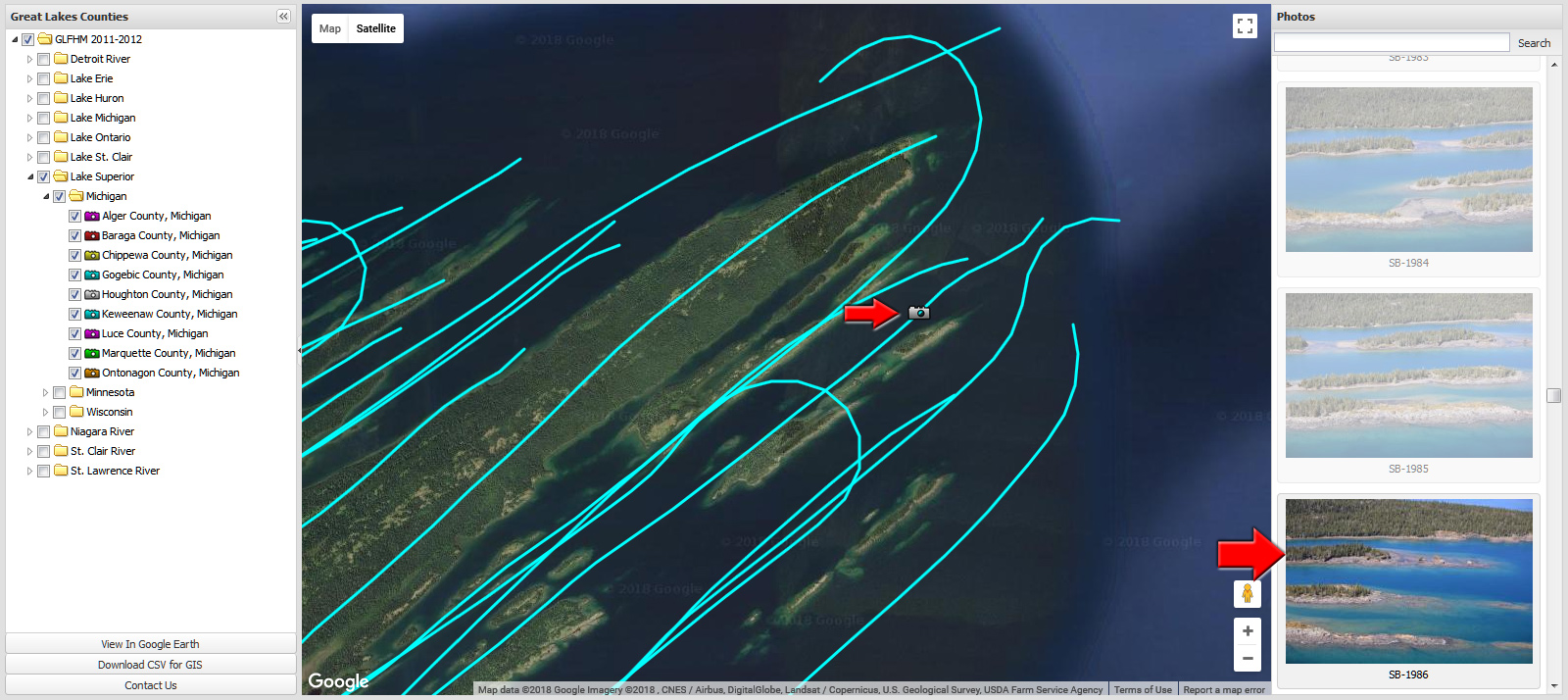
Here I've zoomed in to the eastern end of Isle Royale National Park.
Each colored track represents the path taken by the airplane that captured imagery of the shoreline.
Hover your cursor over any track and the cursor should change from a 'hand' icon to a 'pointing finger'.
Clicking the track changes the icon to a camera and a series of images will now display in the right hand pane.
The camera represents the approximate position of the highlighted image.
You can scroll the right hand pane to view more images. Selecting
an image will also correspondingly move the camera icon; and
vice-versa.
Note that because the shoreline is so complex here, there are multiple
tracks in the same area- multiple tracks are needed depending on
whether the shoreline was north, south, etc of the track of the
airplane.
Next, let's get to the good stuff.
Click the image or advance to the next step.
<Previous step